
Providing Pedestrians with Safe, Comfortable Access to Parks in Upper Dublin Township
September 30, 2026 /
Every citizen should have a park or recreational space within a 10-minute walk of their home.
This has become a standard goal for planners in park, recreation, and open space plans, but the resources planners have to support this goal don’t often account for sidewalks, narrow shoulders, or driving speeds because this data isn’t always available. In a practical sense, many of the people who live within the walkable border on a ParkServe map would not feel safe traveling the path between their home and the nearest park.
Upper Dublin Township wanted to go further with its commitment to pedestrian connectivity. They wanted to ensure the walk between homes and schools to recreational spaces was a safe, comfortable experience for everyone. We helped them identify residents’ safety concerns and develop a practical plan to address them.
Identifying Pedestrian Barriers and Concerns
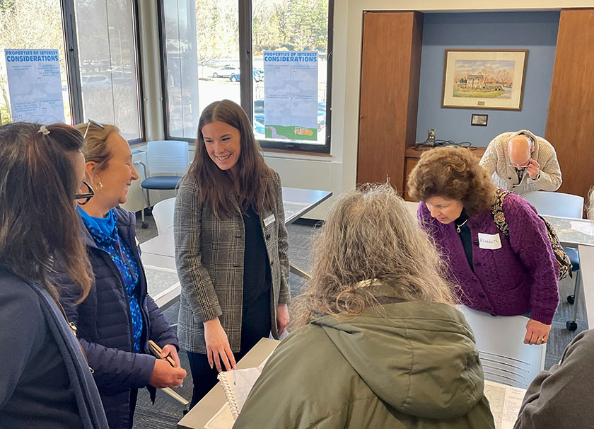
The township had already identified a list of priority areas in need of sidewalks. We used this list as a starting point and conducted extensive public outreach to learn the barriers that were preventing residents from walking to local parks. We surveyed them about how frequently they walk and bike within the community and where they’d like to walk but currently could not access. We also interviewed key community leaders and identified a steering committee of residents to work with the planning team throughout development of the plan. In addition, we held several public meetings during day and evening hours to encourage as much participation as possible. During these meetings, residents were able to mark up a map to indicate sidewalks and trail connections they’d like to walk and designate the location of barriers that made walking unpleasant.
Using this feedback, we developed a list of destinations (parks, trails, recreational facilities, schools, libraries, businesses, transit stops, and employment areas). We also developed and categorized a list of barriers (missing sidewalks, dangerous crossings, narrow shoulders, limited right-of-way, ADA challenges, etc.)
Finally, we analyzed zoning and land use and reviewed other relevant plans from the county and various organizations to see what other destinations and connections are proposed for the future.
Developing practical steps to close gaps in the pedestrian network
After conducting a detailed analysis of all this data, we were able to create a list of 70 missing connections that would close the identified gaps and enhance connectivity. These missing connections include:
Sidewalk
Trail Gaps
Bike Lanes
Pedestrian Crossings
Tunnels
Bridges
Icons from Flaticon.com by Wyasa.Design, Magnific, Iconjam, Adury5711, and Frank Prieto
We also created a GIS-powered mapping portal to display these connections and attach information about the type of connection, why it’s beneficial, its length, location, and a brief description of the required improvements.
Open the map in a new window here
Achieving pedestrian connectivity results
Having a list of projects and getting those projects accomplished are not the same. We wanted to empower Upper Dublin Township to move these projects forward, so we prioritized them based on several factors: safety, equity, need/demand, benefit, cost, feasibility, and grant competitiveness. The goal was to find projects with maximum impact that were achievable within the constraints of a local government; therefore, the sheet also considered factors like right-of-way and easement needs, the price per residential unit, and grant worthiness. We put all of this information into the GIS portal.
With our recommendation, the township formed a committee of staff, residents, and technical professionals to discuss progress and plan for next steps in quarterly meetings. They engage regularly with citizens, businesses, and organizations to align efforts and combine resources. They also meet with the board of commissioners and seek continued feedback from the general population about plan progress and priorities via periodic surveys and the township website. Regular status reports establish accountability to keep the team moving the ball forward.
We continue to work with the township to seek grant funding and building missing connections, one project at a time.
miles of missing connections completed
additional connections currently in design
in grant funding secured

