
Perkiomen Mapping and Flood Mitigation Study
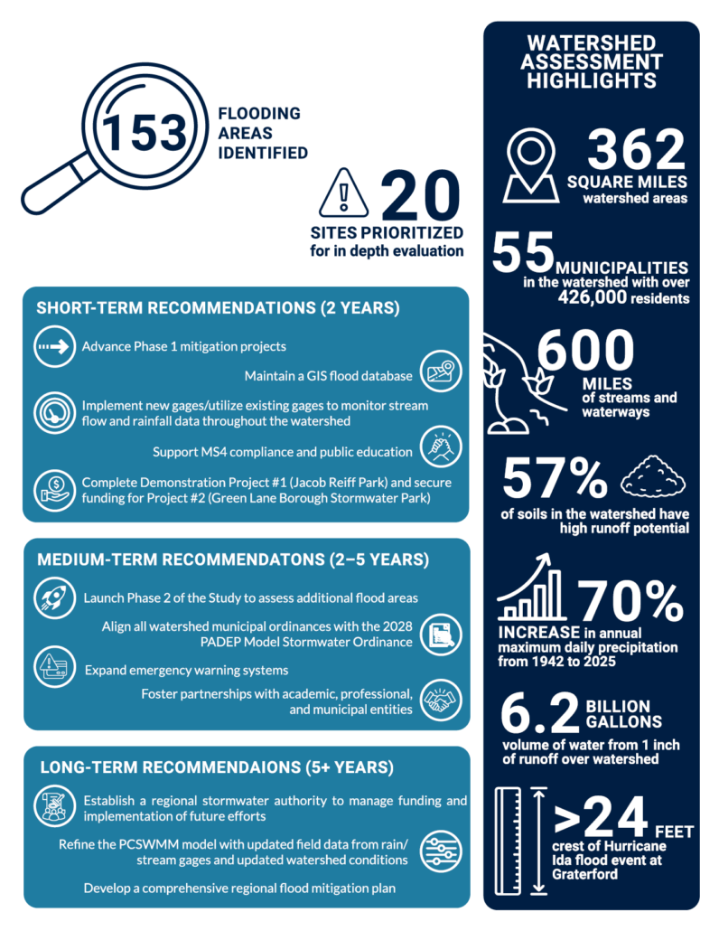
The Perkiomen Mapping & Flood Mitigation Study is a watershed-wide flood mitigation planning effort covering the 362-square-mile Perkiomen Creek Watershed across Montgomery, Bucks, Berks, and Lehigh Counties. The study aims to reduce flooding impacts throughout the watershed and was initiated in response to the devastating impacts of Hurricane Ida in 2021. Team members strived to identify flood-prone areas, evaluate mitigation strategies, and establish a framework for long-term resilience against similar events.
Client / Owner
Montgomery County, PA
Related People
Contact an HRG Water Resources Professional for more information on this project or related services.


