Posts

Meade Avenue Relocation Recognized with Dauphin County Premier Project Award

Meade Avenue

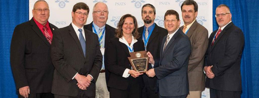
The Dauphin County Planning Commission honored the Meade Avenue Relocation project at its 4th Annual Premier Projects Award Ceremony on January 12, 2016.

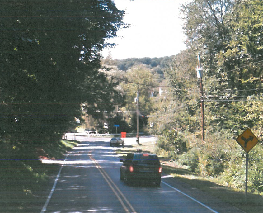
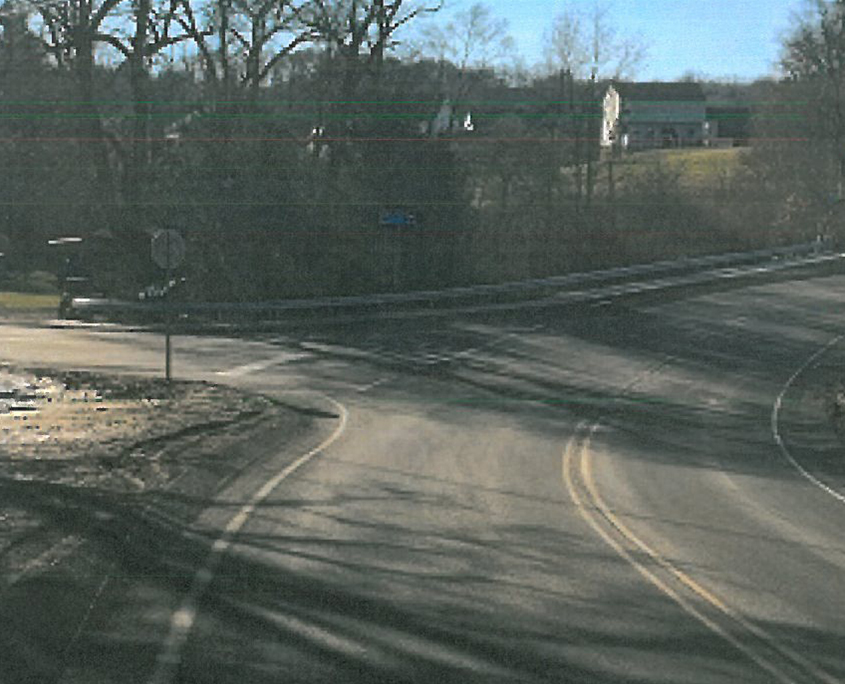
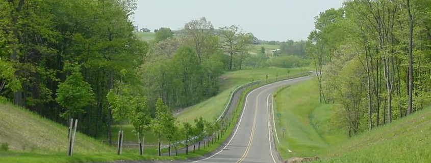
HRG served as the civil engineer for this project, which involved reconstructing and upgrading one mile of University Drive and relocating Meade Avenue.  These improvements increased safety on the Penn State Harrisburg campus by providing an alternate route for truck traffic that had previously crossed through campus to access the Capital Business Center.

The project was one phase of a long-term transportation planning effort in which HRG worked with diverse stakeholders from the university, Lower Swatara Township, the Susquehanna Area Regional Airport Authority, Jednota Estates and others to address conflicting traffic patterns that were limiting economic development in the area and endangering safety.

It was chosen for recognition in the Infrastructure category because it demonstrates the link between infrastructure and economic development while providing an example of how to achieve consensus among community groups with diverse and seemingly incompatible needs.

Chris Bauer, the project’s engineering manager, said, “We want to congratulate Lower Swatara Township for their leadership and initiative in bringing these groups together for the betterment of the community.  We are proud to be a part of the improvements this long-term planning is bringing to the region.”

ABOUT HERBERT, ROWLAND & GRUBIC, INC.

Originally founded in 1962, HRG has grown to be a nationally ranked Top 500 Design Firm, providing civil engineering, surveying and environmental services to public and private sector clients. The 200-person employee-owned firm currently has office locations in Pennsylvania, Ohio, and West Virginia. For more information, please visit our website at www.hrg-inc.com.

Form-Based Zoning Can Bring Municipalities and Developers Together on the Walkable Communities Buyers Want

Photo by North Charleston.  Published here under a Creative Commons license.Walkable Community

The National Association of Realtors (NAR) recently released the results of a nationwide poll showing millennials increasingly prefer walkable communities over the spread-out developments in many present-day suburbs. Other studies have confirmed similar preferences for walkable neighborhoods and mixed-use development; however, traditional zoning approaches, which emphasize low-density development and a separation of land uses, makes it difficult for residential developers to obtain approval for these communities. This article explores the rise in popularity of the walkable community and discusses how residential developers and municipal planners can use form-based zoning to create a community that meets the needs of everyone.

The Case for Walkable Communities

In 2013, NAR’s Community Preference Survey found that 60% of respondents preferred a neighborhood that mixes housing with stores and businesses within walking distance, and 55% would give up a home with a bigger yard in order to get one within walking distance of schools, stores and restaurants.

Additionally, a study by Gary Pivo at the University of Arizona’s Urban Planning Program and Jeffrey Fisher at Indiana University’s Kelly School of Business found that – other factors being equal – enhanced walkability increased the value of both residential and commercial properties.  Using data from the National Council of Real Estate Investment Fiduciaries and Walk Score, they compared more than 4,000 office, apartment, retail and industrial properties and determined that a 10% increase in walkability increased property value by up to 9% for all but the industrial properties.  (There was no discernible impact on industrial properties with a higher walkability score.)

This is in line with other studies of traditional neighborhood developments (TND) published in Real Estate Economics and the Journal of Urban Economics, which found that buyers were willing to pay between 12-15% more for pedestrian-friendly homes in the studied neighborhoods, compared to similar homes in neighboring low-density communities.

Increased property values benefit the developer selling the home, but they also benefit the local municipality as they increase property tax revenues. In addition, high density, walkable communities reduce the amount of infrastructure (such as roadways, traffic signals, water and sewer line extensions) needed to connect spread-out developments, which can save the  municipality money that would’ve been needed to maintain that infrastructure.

The most important reason for municipalities to consider making their zoning friendlier to walkable communities, however, might be their desire to stay competitive as a place people want to live.

Millennials represent a demographic of 80 million people, and they are the generation that will be buying homes and putting down roots in the years to come. Michael Myers, a managing director at The Rockefeller Foundation, is quoted in an article on The Atlantic’s CityLab website, saying, “As we move from a car-centric model of mobility to a nation that embraces more sustainable transportation options, millennials are leading the way…Cities that don’t invest in [these options] stand to lose out in the long run.” 

Bridging the Municipal-Developer Gap with Form-Based Zoning

If municipalities and developers agree that walkable communities can be beneficial, why aren’t more of them being built?

Over the past few years, these communities have become more and more popular with both developers and municipalities, but acceptance still is not widespread. Traditional zoning ordinances could be one of the reasons why.

Traditional zoning ordinances separate land uses into distinct zones: Commercial is separate from residential. Single family homes are separate from apartments and townhomes, etc.  This prevents the construction of developments that combine commercial and residential uses of different types in one space like modern walkable communities do. In addition, traditional zoning has emphasized a low-density approach because communities associate higher density with a loss of open space and community character and fear higher density developments will drain community resources.  However, developers require a higher density approach in order to make the many amenities (such as recreational facilities and civic and commercial spaces) affordable in a typical walkable community plan.

But form-based zoning could be the bridge that closes the gap between a community’s concerns and a developer’s needs.

Rather than fixating on density values and strict land use definitions, municipalities using a form-based zoning approach create a vision for the type of community they’d like to have and set standards to realize that vision.  If they want a community that encourages walking and social interaction in public spaces, they can set standards that will promote these activities.  For example,  Public Space standards can specify the types of pedestrian amenities, greenspaces and recreation requirements that make a place feel safe, comfortable and walkable.  They can also set the size of a standard block and govern how roadways and pedestrian amenities interconnect.  (Keeping the size of blocks small will make them more manageable for walkers, and interconnecting streets will provide shorter routes and more evenly distribute car traffic throughout the roadway network.  This will, in turn, have the added benefit of reducing congestion that comes from concentrating cars on just a few heavily travelled corridors, as is common in many traditionally zoned communities today.)

By using a form-based approach, municipalities can focus more on the form and feel of a community, instead of limiting development to strictly separated zones with a one-size-fits-all regulation of lot sizes.

In turn, residents enjoy the quality of life they seek, and municipalities can continue to attract growth, maintain a healthy tax base, and reduce the expenses associated with sprawling infrastructure. Meanwhile developers are able to meet a market demand profitably without navigating an unnecessarily lengthy entitlements process.

This type of approach allows communities to remain relevant and competitive in the decades to come as millennials age, take their resources and preferences to market, have kids and nurture the next generation. Municipalities and developers that dismiss these trends as merely a fad may be taking a big risk. Is it worth it?  We will know in 20 years.


HRG excels at bringing developers and municipalities together to meet the needs of a community in a way that benefits all parties. To discuss how walkable communities could benefit you, please contact us

Assessing the Condition of Large Sewers

Figure1Determining the condition of large sewers can be challenging, but multiple tools are available to help. This article, which was published in the October 2015 issue of Keystone Water Quality Manager magazine, provides a brief review of large sewer condition assessment tools and gives some guidance in deciding which to use.

Knowing the condition of your sewer system now can save you major headaches (and money) down the line. The investment you make today in conducting regular inspections of your pipes and pump stations will help you avoid emergencies like burst pipes and sewer overflows tomorrow, but it will also help you make better decisions about where to allocate limited revenues in terms of maintenance, repairs, and replacements.

Even though the investment in a condition assessment is worthwhile, you want to make sure you spend those assessment dollars wisely and get the data you need in the best possible quality for the lowest possible cost. Many tools are available, and each one is suited to particular needs. Which tool is right for your system? Let’s take a look at the strengths and limitations of some of the most popular methods of sewer inspection available today.

 Knowing What Each Tool Can Do

1. Zoom Camera
A handheld or truck-mounted zoom camera is a great tool for quickly assessing the condition of large sewers. A zoom camera enables you to see for several hundred feet down the sewer line, but the view is limited by any obstruction to line of sight (such as grease, cobwebs, debris or a deflection in the sewer). In addition, the camera will only allow you to see above the water level.

2. Acoustic Assessment
Another quick assessment method is the use of acoustics. The ability for sound to pass through the sewer provides an indication of whether a blockage exists or not. However, it is not a complete assessment and will require some additional inspection work. Still, an acoustic assessment can cost about a quarter of the price of basic closed circuit television, so it can be used to save money by focusing more expensive data collection methods only on areas the acoustic assessment has identified to have potential blockages (as opposed to using a more expensive, but more thorough tool throughout the entire system).
CCTV

3. Closed Circuit Television (CCTV)
CCTV has been used for many years to evaluate sewers, and it can be customized to the needs of your unique system because of the different types of cameras and vehicles that are available. A conventional pan and tilt camera may be sufficient for some pipes, but a fish-eye type camera lens can be used for a virtual pan and tilt that is somewhat more comprehensive.

CCTV provides a visual assessment of the sewer, but it can also be helpful in identifying buried manholes or revealing other unknowns in the connectivity of the sewer system.

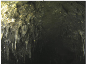
In the past, it was a challenge to obtain sufficient lighting to get a clear picture of large sewers (see figure on the right), but new technology solves this problem by using a strobe light and stitching a series of images together, rather than recording continuous video.

4. Sonar
While some tools like the zoom camera cannot provide data on the condition of pipes below the water surface, sonar can. Therefore, it is useful for identifying debris and sensing connections below water level. However, some water must be in the sewer for the use of sonar to be possible.
Laser Profiling

5. Laser Profiling
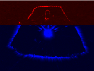
Laser profiling can reveal buried manholes or other connections to the sewer that may not have been realized and can also be used to assess pipe wall loss (as long as the original sewer size information is available and can be entered into the software). However, like the zoom camera, laser profiling can only be used to see above the water level. Therefore, it’s wise to combine it with sonar and CCTV in order to get a complete assessment of the sewer condition, as seen in the figure on the right. (The red shows results from the laser, while the blue shows results from sonar.) For a recent project involving 70,000 feet of sewer, the cost to use these three tools together was approximately $5-6 per foot.

6. LIDAR (3D Laser)
LIDAR is an advanced technology alternative to standard visual and photographic inspection methods. It uses 3D optical scanners to collect simultaneous data and images, which can be used to produce a 3D model of the sewer. This model can then be used to measure, identify deficiencies, and make recommendations for rehabilitation or replacement. It can also be used in 3D infrastructure system modeling and management applications when combined with equally accurate pipe and structure positional data. One instance 3D data is especially useful is in manufacturing the lining for a bend in a sewer.

As an advanced technology, LIDAR provides more comprehensive data than a zoom camera or CCTV inspection could. As an added bonus, the optical scanners are typically inserted into the sewer from the surface, eliminating the need for a person to enter the confined space of the sewer and the associated dangers they could encounter.

7. H2S Gas Sensor
An H2S Gas Sensor is helpful in cases where there is concern about corrosion. The sensor can be mounted on a multi-sensor platform to provide additional insight into the state of the sewer.

8. Gyroscopic mapping
Gyroscopic mapping is used to obtain X-Y-Z coordinates of the sewer along its length, so it’s helpful for identifying the location of bends or changes in elevation. However, this tool requires known X-Y-Z coordinates at the starting and ending points of a sewer.

For large sewers, a small pipe needs to be pulled through the large pipe as a host for the probe, leading to some limitations in the information gained. However, this tool can be useful for facilities such as force mains where changes in direction are often not seen from the surface.

9. In-pipe Ground Penetrating Radar (GPR)
GPR inside the pipe gives insight beyond the sewer itself. It can reveal void spaces outside the sewer line, such as may be caused by infiltration. It can also shed light on the thickness of concrete covering rebar in the sewer.

Deciding Which Tool is Right for You

With a clearer picture of what each tool can and cannot do, you’re better prepared to decide which one will produce the best results for your system. In doing so, here are some things you should consider:

1. Understand your goals.
Consider what you want to gain from the assessment. For example:

If you know the sewer segment has concerns and has bends in it, then 3D LIDAR may be desirable as a means of mapping the sewer.

If blockages are your concern, acoustic rapid assessment may be a good starting point to help narrow the focus on runs where you want to perform further evaluation.

If you have seen evidence of corrosion in manholes and have a concrete pipe, an H2S sensor may be in order.
If you want information on the whole pipe and cannot bypass the flows, you will need to supplement a technology like CCTV with sonar in order to see below the water surface.

When defining your goals, be sure to solicit the input of all levels of staff and the ways they can benefit from the data.

2. Consider combining technologies to address different needs.
Each tool described here has strengths and limitations, so no technology is perfect for all conditions. Laser profiling and sonar can be combined to get thorough data above and below the water surface. An acoustic assessment can be used as a preliminary method in order to identify any blocked pipes that require more detailed assessments. An H2S gas sensor may be needed for pipes that may have corrosion, but you may have pipes of varying material throughout your system and may not need to pay for this technology everywhere. By working with a knowledgeable consultant, you can customize a plan using several different technologies only where they are needed in order to maximize the use of your budget resources.

3. Recognize that special equipment availability may affect your schedule.
Specialized equipment is not as readily available as basic equipment, so, if quick turnaround is necessary, you may want to plan your schedule around any specialty equipment needs.

4. Understand the sewer material being investigated.
If the sewer is concrete, corrosion is a real concern, so an H2S gas sensor or laser profiling may be needed. (This is not the case if the sewer is vitrified clay.)

5. Consider the ground surface.
Is there evidence of settlement on the surface near sewer lines? If so, perhaps in-pipe GPR should be considered to look for voids that have developed around the sewer.

6. Recognize your flows.
Some of the tools described here have specific water flow requirements. For example, CCTV and laser profiling require head space above the water to be effective, but sonar needs a certain depth of water over the bottom of the sewer (as well as any debris present) in order to be successful. Therefore, you will need to coordinate with appropriate staff to implement a means of controlling the flow of water through these lines.

Water flow also impacts the types of vehicles used to carry the various tools through the sewer. Depending on your flows, a crawler may work well, or a float platform may be more suitable. Wheels can be put on float platforms, so additional space is needed for clearance.

7. Plan for the unexpected.
As much as you try to consider every goal and every possible need, each job involves surprises. (If you knew exactly what you’d find in the pipes, you wouldn’t need an inspection, after all, would you?)

That’s why you should design a plan that is flexible for changing circumstances and build extra time into your schedule. Decide ahead of time what will be done if a buried manhole or substantial debris is found: Will you uncover the manhole now? Will you clean the debris out right away or just note it in the report?

The vehicles carrying the inspection tools can often travel thousands of feet if there are no drops or other concerns, so you may not need to access every single manhole during a condition assessment. However, you should still have a method in place for identifying each manhole in case needs change. (Also, individually identifying each manhole – even those not uncovered for access – is essential for logging the findings of your assessment in a report.)

Develop IDs for every manhole – even those you don’t plan to access — prior to inspection and have a plan for how to ID structures if one is found during the investigation. This can reduce confusion and make post-processing more efficient.
A thorough assessment of the condition of your sewers is crucial to optimizing system performance, determining maintenance and repair needs, and budgeting for the eventual replacement of aging infrastructure. It can also help you discover problems before they result in a system failure or reduced service to your customers. While inspections can cost thousands of dollars, they can save you thousands more if they prevent a sewer main backup or break (and the associated costs to repair the sewer and other infrastructure the break may have damaged). They also help you better target your cleaning and maintenance efforts to where the work is needed most.

In determining which technology to use for a condition assessment, you need to consider the materials of your pipes and the volume of flows through them, the goals you plan to accomplish, and your timeline for completing the work. Some tools like a zoom camera or acoustic assessment provide quick data but may need to be supplemented with other methods if blockages are found or more detail is needed. Other tools like laser profiling and CCTV will only provide data on the condition of pipes above the water line, so additional technologies like sonar will be needed to assess the pipes below water level. Some technologies like 3D LIDAR and gyroscopic mapping provide a high level of detail that may be necessary for certain specialized cases.
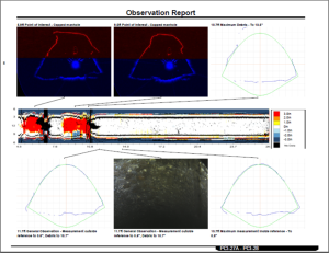
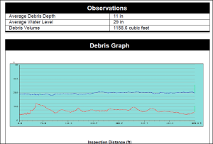
 

figure4     Figure5

The figures above illustrate some meaningful findings from a condition assessment. The “shape” of the pipe resulting from sonar and laser profiling is compared with the design shape of the pipe in the figure on the left, indicating helpful information such as debris and uncovered manholes (the red spots). The quantity and distribution of debris as shown in the figure on the right will help in developing bidding documents for a cleaning project and getting better prices.


In order to provide the best possible data at an optimized price, it is wise to seek the counsel of an experienced professional who can customize a plan that uses several different technologies based on the varying conditions throughout your system.

With the right tools, you can ensure you get the data needed to keep your system functioning at optimum levels for all your customers for several years to come.


Matthew CichyMatthew Cichy, P.E. is a water and wastewater senior project manager responsible for a variety of engineering tasks, including water and wastewater facilities planning, the design of water distribution systems, wastewater collection and conveyance systems, pumping stations, and water and wastewater treatment plants as well as construction administration, field inspections, financial consulting, and project management.

Bruce HulshizerBruce Hulshizer, P.E. is also a project manager in HRG’s water and wastewater service group. He has two decades of experience in civil engineering and is an active member of the Pennsylvania Water Environment Association, where he serves as their co-chair of the Collection System Committee for 2015.


Building Voter Support for Stormwater Fees

Hand vote

Many local officials realize the need to improve stormwater management to protect water quality, but fear constituents would oppose a new fee for stormwater services. Experience shows a transparent approach that involves community stakeholders can build consensus.

by: Adrienne Vicari, P.E.
 

(These tips are excerpted from an article we published in the October 2015 issue of Pennsylvania Township News magazine and are used here with their permission. Reprints of the entire article are available upon request.)

Increasingly stringent stormwater regulations are causing municipalities to think about how they can fund badly needed stormwater system improvements in their community. Many municipalities are considering funding their program through user fees charged by a municipal authority, as authorized by Act 68 of 2013, but some municipal leaders worry that a new fee may be unpopular with residents and businesses.

Though stormwater utility fees are still largely unchartered territory in Pennsylvania (less than a dozen communities have established one here), the use of dedicated stormwater utilities and stormwater fees is a nationwide movement that has seen steady growth over the past four decades. Western Kentucky University reports that there are more than 1,500 stormwater utilities throughout the United States and Canada, serving communities as small as 88 people to more than 3 million. Their success in building consensus among constituents for stormwater fees can show local municipalities a path to approval in their own community.

HRG has used information from the Western Kentucky University study, the nationwide non-profit Water Words That Work, and several case studies published by the EPA (along with our own experience implementing stormwater authorities) to come up with several tips on how municipalities can build local support for stormwater user fees.


  1. Make sure you have identified and involved all the potential stakeholders – even those who oppose the formation of a utility – and form a stakeholder advisory committee. If you don’t attempt to address the concerns of your opposition in these committee meetings, they can come back to haunt you later when it comes time to pass the resolution. According to the EPA case studies, this is what happened in Dover, New Hampshire, and Huntsville, Alabama. Both communities had small advisory committees, but they did not engage all community groups. Though there was unanimous consent among the committee members to form a stormwater utility, the opposition of certain community groups who had not been represented on the committee ultimately drowned out their voices, and the municipal leadership declined to pass the resolution.
  2. Make the stakeholder committee an open forum where people feel comfortable expressing all points of view. Again, you want to deal with any potential obstacles proactively, rather than be blindsided by them in the final stretch. Stakeholder advisory committee meetings are more conducive to problem-solving and negotiating in a deliberative way than public meetings are. By including your opposition early in the process and giving everyone a chance to speak freely, you ensure that major obstacles to support will have been addressed before a public vote.
  3. Have your stakeholder committee discuss the stormwater program and what it can accomplish first. Don’t bring up funding till you’ve established a need for improvements and motivated people to support them. People need to know what they’re getting before they can be motivated to hand over their money.
  4. Clearly define the benefits of the program in all public outreach efforts. Tell people exactly what improvements you intend to make with the money you raise, and quantify the benefits of those improvements whenever possible. For example: “This project will reduce the likelihood of flooding along Main Street by 75%.”
  5. Show, don’t just tell. Visuals are particularly persuasive. Water Words That Work found that showing people photographs of how the fee would be used had the single most dramatic effect of any information provided in gaining approval of the fee.
  6. Choose your words carefully. Name the fee to clearly convey the service you are providing. “Stormwater management” is too vague and largely meaningless to the average person, but “clean water protection” has obvious value. In the Water Words That Work survey, “pollution control and flood reduction fee” tested better than any other term containing the words stormwater, authority or utility.
  7. Emphasize fairness. People generally believe that those who use a service most should pay more for it, so show them how your fee ensures that is the case. Explain why it’s important that non-profits pay the fee because they, too, contribute to stormwater discharges (often more than residents because of their large impervious parking areas). Tell them about credits that people can receive if they lower their stormwater impact by installing green infrastructure on their property. In general, people perceive fees based on actual impervious area to be the most fair and equitable (as opposed to a flat rate), but some of the communities EPA studied did successfully enact flat rates with effective public education about the reasons why that option was chosen.
  8. Demonstrate cost-effectiveness and be transparent about finances. If a stormwater utility is truly the best approach for your community, the numbers will convey that, and detailed economic studies are always an integral part of the planning process. Use those numbers to prove that the stormwater fee will better accomplish program goals than general fund revenue or any other option available. Voters can often be mistrustful of a government’s ability to use funds wisely. Being transparent about program finances (how the fee was determined, how it will be used) eases minds and reduces the chance of a legal challenge.
  9. Define this as a local solution to a local problem. Avoid talk about state and federal mandates or general environmental goals. If flooding is a recurring problem in your community, show how this program will reduce that problem. If pollution is a concern, talk specifically about keeping local waterways clean: the stream families teach their children to fish in, the lake where they go swimming.

Determining whether a stormwater utility is the most effective way to fund infrastructure needs in your community is a complex process that requires dual expertise in civil engineering and financial consulting. Unfortunately, some communities are afraid to even investigate the option because they believe their constituents will never approve of a stormwater fee.   In communities where utilizing general tax revenue is not the best fit approach, research by EPA and others cited in this article shows that an effective public outreach program, which includes key stakeholder groups in the earliest planning stages, can be successful in persuading people to accept stormwater management fees.


VicariAdrienne Vicari, P.E., is the financial services practice area leader at HRG. In this role, she has helped the firm provide strategic financial planning and grant administration services to numerous municipal and municipal authority clients. She is also serving as project manager for several projects involving the creation of stormwater authorities or the addition of stormwater to the charter of existing authorities throughout Pennsylvania. Contact Adrienne about stormwater authorities.
Reduce Speeding with Speed Humps and Other Traffic Control Techniques

Many municipalities have a speeding problem in their neighborhood and wish to address complaints from their residents about safety concerns that result from excessive speed on quiet streets. While those residents often think a stop sign or reduced speed limit will correct the issue, studies indicate that unnecessary stop signs can actually increase speeds on local roads, and speed limits that are reduced below engineering standards are typically ignored.

In a previous post, we explained that the best way to reduce excessive speeding in a neighborhood is to combine education of the community with increased enforcement by police and the construction of engineering techniques that force drivers to slow down. There are many different traffic calming techniques, ranging from planting trees to constructing geometric roadway improvements.  In this article, we describe some common techniques, their cost, and their effectiveness.

Photo by pml2008.  Used under a Creative Commons license.
Street Trees

Street Trees

For a much lower cost than many of the other techniques discussed here, street trees have proven speed and accident reduction power. They also increase the aesthetic value of a neighborhood, reduce pollution, and maintain cooler temperatures, making them a very cost-effective improvement to a community.

Street trees are typically placed at 15-30 foot intervals and must be carefully located to ensure they provide clear sight lines and do not block street lights or utilities.   When designed properly, street trees can reduce speeds between 3 to 15 miles per hour, according to studies cited by urban designer Dan Burden. They also reduce the number of crashes (between 5-20 percent in one study conducted in Toronto).

Though the exact reason for this speed and accident reduction is not known for certain, several theories exist.  Some say the trees act as a visual wall that makes drivers more aware of a possible pedestrian presence.  Others point to the calming effect trees have on us psychologically, suggesting that a calmer mood causes drivers to slow down.

Average cost: Since tree species vary by region, this cost can also vary widely.  However, the average planting cost is between $250 to $650.

Photo by Robert Drudl. Used under a Creative Commons license.
Traffic Calming - speed hump

Speed Humps

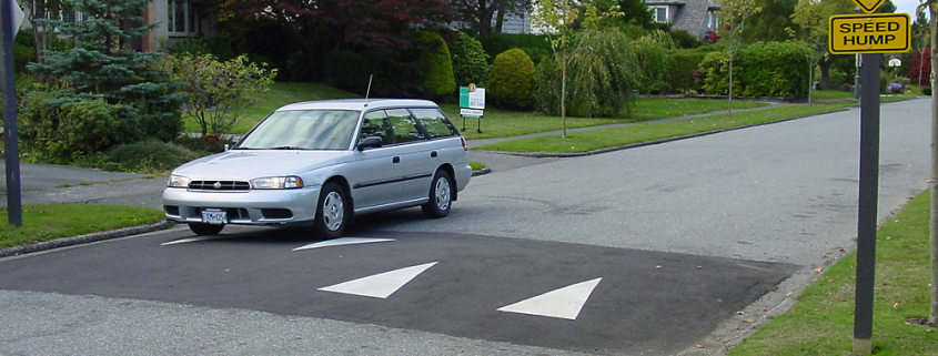
The most commonly used of the traffic calming measures, speed humps are rounded, raised areas of pavement that are placed every 300-600 feet on local roads. They typically include pavement markings and warning signage on the approaches, so that drivers are aware of their presence.

Speed humps can vary in height between 3 and 4 inches. Studies indicate that, if implemented correctly, these humps will cause drivers to reduce their speed anywhere between 4 to 23 miles per hour.

While well-designed speed humps are effective at reducing speeds on local roads, they should not be used on major collectors, bus routes or primary emergency response routes because they slow down emergency response vehicles (up to 3-5 seconds per hump for fire trucks and up to 10 seconds per hump for ambulances carrying patients).

Average cost: According to published information, the cost of speed humps can range from $1,000 to $6,900, and the average is approximately $2,500.

Photo by Andrew Bossi. Used under a Creative Commons license.
Traffic Calming - speed table

Speed Table (a.k.a. flat-top speed humps)

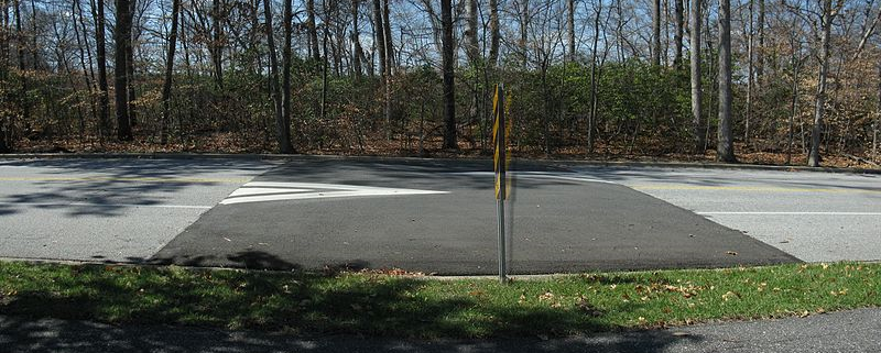
A speed table is similar to speed humps, but the humps are longer: They are typically designed so that the entire wheelbase of a vehicle can rest on top. Speed tables have a flat section on top and ramps on either side, and textured materials such as brick may be used on the flat section.

They do not produce as jarring a ride as speed humps, so they are preferred by emergency responders; however, drivers typically do not reduce their speed as much as they would with humps, as a result.

When used as raised crosswalks, speed tables increase the likelihood that drivers yield to pedestrians, so they are a good choice for increasing pedestrian safety in a neighborhood.

Average cost: According to published information, the cost of speed tables can range from $1,000 to $6,900, and the average is approximately $2,500.

Roundabout

Many people often think of traffic circles and roundabouts as being interchangeable, but they are not. Traffic circles are often more confusing and simply involve building a raised circular island in an intersection. A modern roundabout will also typically include a raised circular island, but it will include flared approaches. Flared approaches align the vehicle to the right of the center island so that merging of traffic is accomplished more easily, and it eliminates confusion. In addition, splitter islands with yield signs are typically included on each leg approaching the intersection, which helps drivers perceive a change in the roadway is coming and proceed with caution.

Roundabouts can reduce speeds between 15 to 25 miles per hour within the roundabout, and they are very effective at reducing crash frequency in residential neighborhoods (as much as 77 percent in one study) as well as crash severity.

Though new to Pennsylvania, they have been used safely and effectively throughout the U.S. in California, Florida, Maryland, and Washington. Pennsylvania has more than 20 roundabouts throughout the state, and another 40 are currently proposed. (You can watch traffic moving through one we designed at the intersection of North Boundary and Marshall Roads in the video above.) Despite opposition from some residents who aren’t familiar with the traffic pattern, roundabouts have been proven to be safer than traditional intersection designs, and they reduce emissions versus intersections with traffic lights and stop signs. They also eliminate the energy consumption associated with operating traffic signals. As a result, federal and state governments are encouraging engineers to use roundabouts wherever possible.

Due to their high cost, roundabouts are typically only considered when intersection improvements are already necessary, as opposed to being used merely as a device to slow traffic.

Average cost: Costs vary greatly, but typically range between $350,000 to $500,000.

 Photo by Robert Drdul. Used here under Creative Commons license.
Traffic Calming - center median

Center Island Narrowing

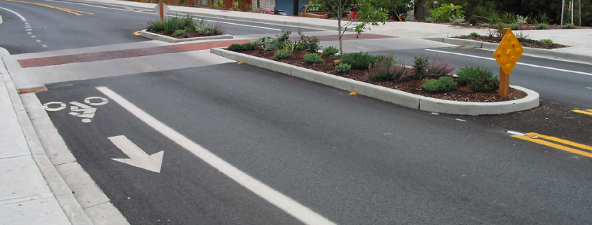
Sometimes called mid-block medians, these islands are located along the center line of a street, thereby narrowing the lanes of travel and causing drivers to slow down slightly.   The islands may help to beautify the area with landscaping and can increase the safety of pedestrians by allowing them to cross one direction of traffic at a time (waiting in the island until the other direction is clear).

Emergency responders typically prefer these islands to other traffic calming devices, but they may reduce parking and driveway access. In addition, bicyclists do not like having to share a narrowed roadway with motorists.

Average cost: Costs range between $5,000 – $15,000.


Steelton Streetscape

Bulbouts

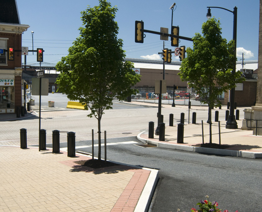
Bulbouts are curb extensions that can occur mid-block or at the intersections. They narrow the roadway, forcing drivers to slow down as much as 4 percent in some studies.

While emergency responders typically prefer these to other traffic calming devices like speed tables and speed humps, bicyclists do not like sharing a narrowed roadway with motorists. (However, bulbouts can be designed to include an island that allows bike riders to continue along the original curb line.)

Pedestrians also find bulbouts useful as they can be used to decrease intersection width, providing a shorter and safer crossing for people at the intersections.  This, in turn, reduces pedestrian crossing times.

But bulbouts must be carefully designed to ensure adequate drainage, and delineators should be used to make them visible to snow plows.

Average cost: Bulbout costs vary greatly but generally range between $15,000 to $25,000.

 Photo by Daniel Mayer. Used under a Creative Commons license.
Traffic Calming - raised intersection

Raised intersections

Raised intersections typically raise the pavement to sidewalk level over the entire intersection using sloped ramps onto a flat, often textured section in the middle, and then ramping back down to roadway height after the intersection.

They are very pedestrian-friendly and reduce intersection speed significantly, but the mid-block speed reduction is less than 10 percent. In addition, they must be carefully designed to ensure proper drainage.

Average cost: Raised intersections range in cost between $25,000 to $70,000.

Most of these traffic calming devices can be used in combination with each other, and, in fact, traffic calming devices should be planned and executed throughout a neighborhood, not on isolated streets. (If the devices are only used on one or two streets, drivers typically switch to alternate routes in order to avoid them, thereby shifting the speeding problem to a new location instead of eliminating it.)

Seeking the assistance of an experienced traffic engineer is crucial to the success of a traffic calming program because many factors must be considered in applying these techniques to ensure they do not cause unintended safety hazards, hamper emergency response, or create drainage problems.

Though the cost to implement these techniques may seem high, funding is available to help municipalities. In another post, we discuss how Act 89 Multi-Modal grants can be used to fund traffic calming projects like these.

The Potential Advantages of a Stormwater Utility for Financing Your Stormwater Management Needs

by: Adrienne Vicari, P.E.

West Clarion University Pond

Two years after the passage of Act 68, many municipalities still have legitimate concerns about whether a stormwater authority would be right for their community. In a previous article, HRG addressed concerns about public opposition, up-front costs, and a loss of control over the infrastructure covered under the MS4 permit. In today’s article, we discuss the potential advantages of stormwater authorities to municipalities searching for ways to finance their stormwater management programs.

Advantage #1: Stormwater authorities enable you to collect money from tax-exempt users.

Churches and non-profit organizations like hospitals contribute a lot of stormwater runoff to the local watershed, but a tax would never collect any revenue from them because they are tax-exempt. By using the stormwater authority structure, you can charge fees to these users and collect their fair share contribution to stormwater management efforts.

Advantage #2: Stormwater authorities can collect fees from multiple municipalities who may be contributing runoff to their watershed; municipalities cannot charge anyone outside their own borders.

Political boundaries and watersheds seldom coincide. Stormwater is not neatly contained by political boundaries, and watersheds often cross through more than one municipality. But townships and cities cannot charge other local governments for stormwater management under state law. A multi-municipal (or joint) stormwater authority, however, can be set up to serve an area that extends beyond the boundaries of a single municipality, which enables everyone within a particular watershed to contribute to the stormwater management services it requires.

Advantage #3: Stormwater authority fees are more equitable than a property tax.

As stated in #1 and #2, stormwater utility fees ensure that everyone who contributes to a community’s stormwater pays for the services they use (even tax-exempt organizations, particularly if a utility is set up on a watershed-wide basis).

But stormwater fees are also much more flexible and responsive to the true nature of stormwater than a straight property tax would be. The value of someone’s land has little to do with how much stormwater it creates, so a property tax is inherently unfair for this purpose. A property could be appraised at a high value and contribute very little to stormwater, but an experienced financial consultant can help set up an authority’s rate structure based on the quantity and/or quality of runoff a property creates (rather than charging a flat fee or basing it on acreage).

A municipality can also offer credits to property owners who install best management practices for controlling runoff. (This has the added bonus of encouraging good behavior: inspiring people to install stormwater control measures like rain gardens, buffers, etc. on their property.)

Thus, a well-designed stormwater utility ensures everyone pays according to how much he or she uses the service.

Advantage #4: Stormwater authorities provide a dedicated revenue stream for stormwater improvements.

Relying on general tax revenue for stormwater improvements isn’t practical for some communities. There simply isn’t enough money to cover all of the needs the municipality must address, and stormwater often falls to the bottom of the list because money is allocated to more high profile projects such as a bridge replacement or pavement rehabilitation. Unless there is major flooding, stormwater is often forgotten and doesn’t receive the financial attention it needs.

With a dedicated stormwater fee, the money is there to maintain, repair and replace stormwater infrastructure on a proactive basis, rather than waiting till flooding causes expensive damage or impacts public safety.

Advantage #5: A dedicated revenue stream for stormwater can improve the finances of a municipality.

It can do so in several ways. First, now that the municipality no longer directs tax revenue to stormwater management, it has more tax dollars available for its other priorities.

Second, debt associated with stormwater improvements is no longer considered direct municipal debt because it can be self-liquidated by the authority’s revenue stream. Therefore, the stormwater debt doesn’t count towards the municipality’s borrowing limit, and its impact on the municipality’s bond rating is reduced. (Since municipal authorities are not subject to the same restrictions on borrowing and bond rating concerns as municipalities, they are often able to implement larger projects or make improvements in a timelier manner than a municipality could.)

Third, many agencies that offer grants and loans expect the municipality to put up matching funds, which is hard to do when you don’t have a dedicated stormwater revenue stream. Even if matching funds are not an official requirement of the grant or loan, most funding agencies place a higher preference on recipients who have money available for the infrastructure because they have a greater confidence in their ability to complete the project if there are issues and to maintain it after it’s done.

Advantage #6: Stormwater authorities are better positioned to raise rates than municipalities are to raise taxes if stormwater obligations increase.

Tax increases are not popular politically, and they are hard to pass. As stormwater infrastructure needs change, municipalities may need a revenue source that is flexible enough to meet those changing demands.

Every municipality’s financial situation and stormwater needs are different, so it’s wise to seek the counsel of a consultant with dual expertise in engineering and financial consulting to determine if a stormwater utility is right for your community. If it is, your consultant can help you organize a program that maximizes an authority’s potential advantages: providing a dedicated revenue stream for stormwater management that is more equitable than other funding sources and freeing up the municipality’s tax dollars for other priorities without adding to its direct debt or negatively impacting its bond rating.


VicariAdrienne Vicari, P.E., is the financial services practice area leader at HRG. In this role, she has helped the firm provide strategic financial planning and grant administration services to numerous municipal and municipal authority clients. She is also serving as project manager for several projects involving the creation of stormwater authorities or the addition of stormwater to the charter of existing authorities throughout Pennsylvania. Contact Adrienne about stormwater authorities.
Overcoming Concerns About Forming a Stormwater Authority

by: Adrienne Vicari, P.E.

pond

Act 68 gave municipal authorities the ability to finance, own, operate and lease stormwater facilities, but, two years later, many municipalities still have questions about whether an authority is right for their community. Aging infrastructure and increasing regulatory obligations from the state and federal government have put a heavy burden on towns across Pennsylvania, and they are searching for ways to finance stormwater management beyond general tax revenue. However, concerns about the upfront investment creating an authority would require and the possible backlash from members of the community give them pause.

Every municipality’s financial situation and stormwater needs are different, so it’s wise to seek the counsel of a consultant with dual expertise in engineering and financial consulting to design a custom solution tailored to those unique needs. If forming a stormwater utility is indeed a good fit for your community, your consultant can help you overcome the typical concerns through a strategic approach built upon sound financial and engineering principles.

Concern #1: The community will be against new fees for stormwater.

It is true that residents, business owners, and non-profit organizations will initially question the need for another bill; no one likes paying new fees. However, municipalities can win public support with extensive community involvement and educational outreach. It’s important to communicate that the new fee will be used exclusively for stormwater management and will not be “raided” for other purposes. It’s also important to show the community exactly how their money will be invested: list the specific improvements you intend to make and use photographs and illustrations whenever possible. Emphasize the fairness of the fee: that everyone pays for the services they use based on the stormwater they contribute to the system (and not simply the value of their property). Accentuate the positive by naming the fee after the benefits it provides to the community (such as a “Clean Water Management Fee”), as opposed to the problems it addresses. Invoice the fee separate from taxes, similar to water and wastewater billing.

Concern #2: It will cost too much to get the authority up and running.

Most municipal budgets are stretched to their limit as it is, so investing money in the start-up costs associated with a new authority is a hard sell when that money could be used for maintenance and repair of ailing infrastructure. But, even though the results are not physically tangible like new culverts or pipe repairs, the money you spend on a new stormwater authority is a true investment in your community’s future. The authority will cost money to get up and running, but it will create revenue in the future that can be used to proactively address stormwater needs before they become costly emergencies. What’s more, that dedicated revenue stream makes you eligible for grants and low-interest loan programs that otherwise would’ve been out of reach because of the need for matching funds.

Speaking of funding, some programs will help defray the start-up costs associated with organizing an authority. For example, West Goshen Township, Chester County, has entered into a 50/50 cost-share with the Army Corps of Engineers for technical assistance with mapping and inventory of their stormwater infrastructure. This step is necessary to develop the Stormwater Management Program and ultimately determine the revenue requirements necessary to establish and justify the stormwater rate.

Depending upon whether the municipality sells its stormwater assets to the authority or leases them, the municipality can also receive an upfront or annual payment from the authority for the transfer of facilities, which will help to absorb some of the start-up costs, as well.

However, municipalities may be able to avoid a lot of the start-up costs associated with an authority by simply adding stormwater to the charter for their existing water or wastewater utility. If they do, the structure and administrative functions (the board, billing, etc.) will already have been set up; the articles of incorporation will just need to be amended.

Concern #3: We don’t want to give away authority over our stormwater infrastructure, especially considering the liabilities we have from our MS4 permit.

Though the municipality can appoint people to its board, ultimately, the authority is an independent body that makes its own decisions. Yet currently the municipality – not the authority – is responsible for any fines incurred from not complying with MS4 permit requirements. This arrangement can easily seem dangerous to many municipal officials, but solutions are available.

A knowledgeable financial consultant can assist in structuring the authority in many different ways to give the municipality flexibility in deciding which powers and purposes it wishes to assign. One option is to set up an operating authority and pair it with a management and services agreement. Under this arrangement, the municipality transfers its facilities to the authority, who collects a rate and charges from local users to finance their operation, maintenance and improvements. The authority then “hires” the municipality to conduct operations and maintenance and perform administrative functions such as billing.

Another option is the reverse leaseback authority. Under this arrangement the municipality continues to own the facilities and finance capital improvements, but it leases the system to the authority for operation, maintenance and the setting of rates and charges.

Hybrid versions of these examples can also be established based upon the priorities and goals of the municipality.

In addition, PA DEP is currently working through amendments to its program which may allow municipalities to transfer their MS4 permits to a stormwater authority along with the drainage and stormwater facilities. By transferring the permit, the municipality would also transfer the legal obligations and liabilities that go with it.

As you can see, the concerns that municipalities have about stormwater authorities can be alleviated through joint financial and engineering planning. Though municipalities typically think of their stormwater infrastructure as an issue for their civil engineer, municipal authorities are primarily financial organizations, so a thorough understanding of finance is important to ensure financial and legal obligations are met in the most advantageous way to the municipality as possible. With fears allayed, municipalities are then able to see the many advantages a stormwater authority offers. In our next post, we discuss these advantages of forming a stormwater authority.


VicariAdrienne Vicari, P.E., is the financial services practice area leader at HRG. In this role, she has helped the firm provide strategic financial planning and grant administration services to numerous municipal and municipal authority clients. She is also serving as project manager for several projects involving the creation of stormwater authorities or the addition of stormwater to the charter of existing authorities throughout Pennsylvania. Contact Adrienne about stormwater authorities.
Better Roads for Less Money with Asset Management

Freshcorn Road
Municipal managers are under pressure every day to deliver more services in spite of shrinking budgets. With only so much money available, they must make tough choices about what investments to make in their community. Though they’ve heard the benefits of asset management many times in recent years, they still don’t feel they have the money to invest in such programs – not when that money could be spent on the construction or repair of badly needed roadways, bridges, and pipes.

Many communities see asset management programs as an additional expense, but the truth is: asset management saves you more money than it costs.


See also: Position Yourself for Funding With Asset Management & Capital Improvement Planning


Imagine a tale of two cities: both celebrating the ribbon-cutting on a brand new roadway and each taking a very different approach to caring for it.

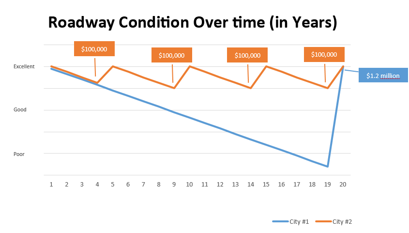
City #1 has no asset management or capital improvement planning program. It does not assess the condition of its roadways and plan long-term investments in their upkeep. It makes repairs when the need becomes obvious.

City #1 will make moderate investments in maintenance over the next 20 years, but the condition of the roadway will steadily decline. Ten years after the ribbon-cutting celebration, the roadway condition will be fair at best. Fifteen years after, the residents who heralded its construction will be grumbling about its potholes and cracks. Twenty years after, the condition of the road will be so poor that City #1 will need to completely replace the roadway at a cost of $1.2 million per lane mile.

City #2, on the other hand, has a robust asset management and capital improvement planning program. It routinely inspects the condition of its roadways and takes proactive action to keep those roadways in top form. With investments every five years of approximately $100,000 to resurface the pavement, City #2 maintains its roadway in good condition throughout the next two decades, keeping traffic flowing smoothly, encouraging growth and development, and making residents and local businesses happy. The condition of the roadway never declines to a state where travelers complain.

Roadway Conditions Over Time Graph

Over the same 20-year-period, the residents of City #2 will ultimately have paid less money ($400,000) than City #1 ($1.2 million) but will have enjoyed better roadway conditions over the long-term.

Still think you can’t afford to invest in asset management and capital improvement planning? As these two cities show, you can’t afford not to.

Stop Speeding in Your Neighborhood

A version of this article was printed in the September 2017 issue of Pennsylvania Borough News magazine.

stop speeding

A comprehensive traffic calming program that includes community education and involvement, enhanced enforcement, and engineering control is the most effective way to stop speeders and make your neighborhood safe for pedestrians.

Municipal officials frequently get calls from their residents about speeding on local streets.  People are worried that they or their children might get hit by a car, or a dangerous vehicle collision could occur.  These are valid concerns that need to be addressed.  Unfortunately, many residents think stop signs are the way to fix the problem, and they pressure their officials to post them on their street.

But stop signs do not reduce vehicle speeds.  They are meant to indicate who has the right-of-way when traffic is coming from different directions, and state DOTs require municipalities to conduct a stop sign warrant analysis to make sure the intersection meets the conditions necessary to require a complete stop. If a municipality installs a stop sign where it is not warranted, it can present liability concerns, and studies indicate that stop signs are not effective for reducing speed anyway.

Drivers respond more to roadway conditions than signage – especially if they feel that signage is in conflict with those conditions.  In study after study, drivers who come to a stop-controlled intersection with no other traffic in the area frequently roll through the sign, slowing down for a few seconds rather than coming to a complete stop.  Then they often speed up more aggressively after moving through the intersection to make up for lost time.

A study conducted in Michigan by Richard Beaubien and published by the Institute of Transportation Engineers showed that placing stop signs along a roadway increased driver speeds, rather than decreasing them, and studies in Boulder, Colorado, and California have had similar results.

Lowering the speed limit below typical roadway safety standards is also ineffective because most drivers travel at a speed they deem typical for the roadway conditions, rather than constantly checking their speedometer against speed limit signs.

So what can you do to stop speeding on your local roads?

Institute a neighborhood traffic calming program that emphasizes community involvement and combines education and enforcement with engineering techniques such as speed humps.

Educate your residents with a community awareness campaign
Studies and enforcement data history indicate that the majority of speeding on local roads is done by drivers who live in those neighborhoods, so a community education campaign that includes articles in the municipal newsletter or posters at community gathering places (such as schools, libraries, and recreation centers) can be very effective at increasing awareness and reducing speeds.  Articles in the local newspaper or community magazine can also be helpful if the problem is significant enough to warrant it, and yard signs reminding people to slow down reinforce the point.

Back it up with enhanced enforcement
When educating the public about a speeding problem in your neighborhood, it’s important to tell them why you want to reduce speeds (including information on any crashes that may have occurred or the compromised safety of pedestrians).  It’s also important to connect your education effort with enhanced enforcement by police and let people know that tickets will be issued.  Education by itself will not deter speeders for long; the threat of fines is necessary to reduce speeding over the long haul.

Control speed with engineering devices (like speed humps), as needed
While education and enforcement can help reduce excessive speed in most situations, sometimes drivers need an extra nudge or reminder to slow down.  A traffic engineer can help you install measures that will encourage or even force drivers to slow down such as speed humps, rumble strips, traffic islands, road narrowing, and pavement markings.  (In another article in this series, we describe each of these measures, their cost, and their effectiveness.)

A comprehensive traffic calming program like this that combines education, enforcement, and engineering design can be very successful at eliminating speeding on local roads, but governing requires the consent of the governed.  Therefore, the effectiveness of a traffic calming program depends most of all on how invested the community is in making it work.  This makes community involvement from the earliest stages very important.

Many communities find it helpful to create a committee of residents to address traffic concerns in the neighborhood.  The committee can provide information on speeding and other traffic issues and work with the municipal officials, their retained engineer, and police to devise a strategy to address them.  All final decisions are made by municipal officials, but the committee plays a significant role in advising them and helping to determine a solution.

Working as a team, municipal officials, law enforcement, and residents can make roadways safer for the entire community.


For more information on traffic calming programs, read our other articles:

Traffic Calming - speed humpSpeed Humps and Other Traffic Control Techniques

There are many different traffic calming techniques, ranging from planting trees to constructing geometric roadway improvements.  Read a description of the most common techniques, their cost, and their effectiveness.


Benefits of Traffic Signal Retiming Outweigh Costs 40:1

Traffic

This article was published in the June 2010 issue of Borough News magazine and is reprinted here with their permission.

If someone told you that you could spend as little as 1 percent of your transportation budget on an effort with up to a 40:1 return on that investment, would you believe him?  If he’s talking about traffic signal retiming, you should.

Often overlooked in favor of more high profile construction projects, traffic signal retiming is an inexpensive but hugely cost-effective effort that returns wide-ranging benefits, including reduced congestion and driver delay, reduced fuel consumption, and reduced air pollution, among others.  And the Institute of Transportation Engineers estimates these benefits could be gained for as little as 1% of public transportation funding but would return benefits outweighing the cost by 40:1. In this economic climate, that’s an investment that’s hard to beat.

Benefits of Traffic Signal Retiming
The goal of traffic signal retiming is to minimize the time vehicles moving in any direction have to wait at an intersection.  It involves prioritizing the signals in your community; determining which signals or groups of signals exhibit the most delay; collecting data on the current operations of the signal, including traffic counts and turning movements; modeling the traffic to determine a new timing plan; adding the revised timing plan to your Traffic Signal Permit Plan; and submitting it to PennDOT for review.

Once PennDOT approves the plan, it is implemented and monitored to determine if any further fine-tuning is necessary. The primary reason municipalities consider traffic signal retiming is to reduce congestion and driver delay, but this is just one of many benefits of properly timed traffic signals:

  • According to studies by the Institute of Transportation Engineers, traffic signal retiming reduces motorist delay at an intersection by 15-37 percent and reduces the motorist’s overall travel time by seven to 13 percent.
  • Reduced travel time and delay, in turn, decreases motorist frustration.
  • The Institute of Transportation Engineers also estimates that properly timed signals decrease fuel consumption by six to nine percent.
  • Properly timed signals reduce vehicle emissions, as well, thereby improving air quality.
  • In addition, properly timed signals reduce the number of collisions on municipal streets by producing smoother traffic flow and fewer stops. Smoother traffic flow also reduces driver aggression.
  • Improving traffic flow on signalized streets minimizes the number of drivers who take side streets in order to avoid congestion on the main corridors. This will then minimize the congestion and safety problems (as well as wear and tear) caused by use of these streets beyond what they were designed to handle.

Costs and Funding Options
So why don’t more communities retime their traffic signals?  Historically, traffic signal retiming has been seen as one more item in a long list of needs competing for limited public transportation funds.  Plowing, salting, and paving can exhaust a significant portion of Liquid Fuels monies.  If traffic signals are considered at all, it is to replace an extinguished signal lamp or to fix broken equipment.

But traffic signal retiming is an inexpensive effort that can reap huge rewards.  On average, a traffic signal retiming effort costs between $1,500 and $2,500 per signalized intersection. What’s more, a creative engineer with knowledge of the transportation funding process can help you find funding sources for a traffic signal retiming effort in order to reduce the burden on your borough budget.

For example, the SAFETEA-LU federal transportation funding program included a program called Congestion Management/Air Quality (or CMAQ), which has two goals: to reduce congestion and improve air quality – two of the main benefits of traffic signal retiming.  This program has been used effectively across the nation to help local communities fund traffic signal retiming efforts.

In many cases, regional organizations (such as councils of government or regional metropolitan planning organizations) have banded together using CMAQ funds to assist their local municipalities with traffic signal retiming programs.  Here in Pennsylvania, the Southwestern Pennsylvania Commission, a metropolitan planning organization that covers 10 counties surrounding the City of Pittsburgh, engaged a consulting team of which Herbert Rowland and Grubic is a team member, embarked on such an effort in 2008 which is currently ongoing.

The federal SAFETEA-LU bill has expired and is operating under continuing resolution while a new bill is developed.  It is unknown what the final form or format of the types of funding programs will be in the next bill, however it has been reported that there will be an emphasis on the reduction of congestion, greenhouse gas emissions, and improve air quality.

When should signal retiming be implemented in your community?
A municipality should develop a program for the routine traffic signal retiming of all of the signals within the community.  The program should place a priority for retiming on each signal in an effort to ensure that the signals with the most impact on the traveling public are retimed most often.

The Institute of Transportation Engineers recommends that all traffic signal timing plans be re-evaluated, at minimum, every three years to account for normal growth in traffic demand.  It is also important to retime signals any time new homes or businesses are constructed or a shift occurs in the location of employment centers within a community.  Such changes inevitably alter traffic patterns, necessitating revisions to the traffic signal timing plans.

Who should implement signal retiming in your community?
It is important to engage professionals to aid in the development and implementation of a traffic signal retiming program.  It is recommended that these professionals be individuals with specific training and experience in signal retiming and certification as a Professional Traffic Operations Engineer (PTOE).  A PTOE is a person who applies a comprehensive knowledge of technology and scientific principles acquired through study and experience to the supervision of day-to-day operation of traffic systems.  To become certified as a PTOE one must have a valid license to practice engineering (P.E.), a minimum of four years of experience, and pass a written certification examination.

As stewards of the public dollar, borough officials are constantly seeking the most cost-effective ways to improve the quality of life for their community, and, with benefits that outweigh the costs by 40:1, traffic signal timing is perhaps one of the best ways they can accomplish this goal.

For as little as $1,500 per intersection, your borough can enjoy wide-ranging benefits such as reduced congestion and motorist delay, reduced fuel consumption, and improved air quality.  Moreover, funding is available to those who are creative in order to offset the cost of this inexpensive effort.

If your community has experienced residential or business construction or you simply have not examined your traffic signal timing in more than three years, now is the time to revisit your signal timing plans.